واژه های تصادفی
واژه های مجاور
Global Positioning System
Global Positioning System
توضیح فارسی
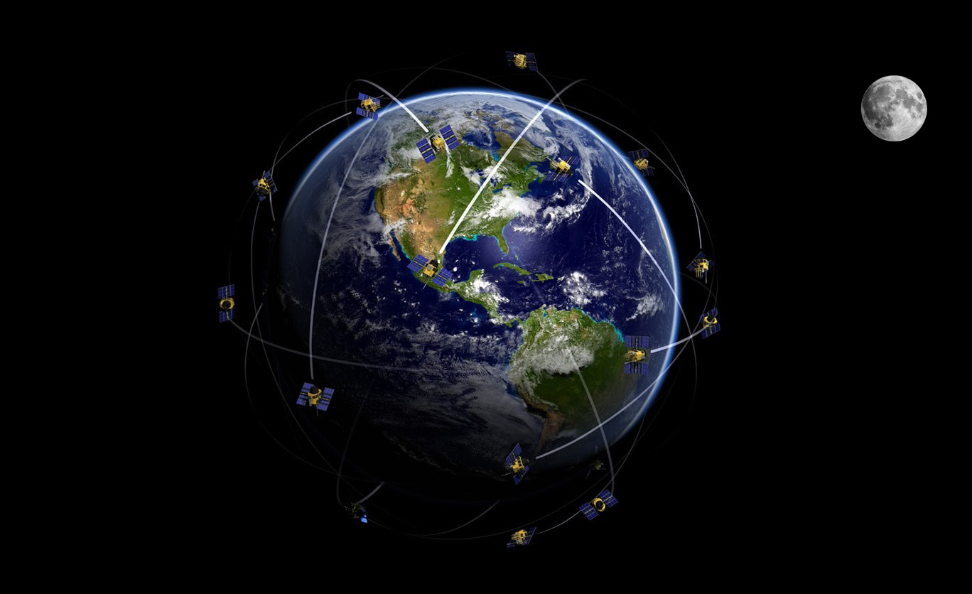
سیستم موقعیت یابی جهانی (GPS) یک سیستم موقعیت یابی رادیویی ، ناوبری و انتقال زمان برای مکان یابی موقعیتهای جغرافیایی است.
سیستم GPS شامل 24 ماهواره است که به دور زمین می چرخند و در هر مدار 4 ماهواره وجود دارد. این ماهواره ها NAVSTAR نامیده می شوند و هر روز دو بار در مدار دقیق به دور زمین می چرخند و سیگنالهای اطلاعاتی را به زمین می فرستند.
این سیستم موقعیت و سرعت و زمان را به صورت بسیار دقیق در سرتاسرجهان و بصورت نامحدود در اختیار کاربرانی که به گیرنده مناسب دسترسی دارند ارائه می دهد و تحت تأثیرشرایط جوّی و آب و هوایی نیست و یک سیستم مرجع و شبکه مشترک در سراسر جهان را فراهم می کند. اطلاعات GPS بصورت دقیق و مداوم از موقعیت مکانی هر ماهواره در سیستم با توجه به زمان و فاصله ماهواره انتقال دهنده به کاربر ارائه می شود. گیرنده GPS به طور خودکار سیگنال های مناسب را از ماهواره های در دسترس انتخاب کرده و آنها را به موقعیت سه بعدی ، سرعت و زمان ترجمه می کند. دقت سیستم برای کاربران غیرنظامی معمولاً 100 متر به صورت افقی است.
Description
Global Positioning System (GPS) is a space-base radio positioning, navigation, and time-transfer system for locating geographical location.
GPS system consists of 24 satellites that orbit the earth and there are 4 satellites in each orbit. These satellites are called NAVSTAR and orbit the earth twice a day in a precise orbit, sending information signals to the earth.
The system provides highly accurate position and velocity information, and precise time, on a continuous global basis, to an unlimited number of properly equipped users. The system is unaffected by weather, and provides a worldwide common grid reference system. The GPS concept is predicated upon accurate and continuous knowledge of the spatial position of each satellite in the system with respect to time and distance from a transmitting satellite to the user. The GPS receiver automatically selects appropriate signals from the satellites in view and translates these into three dimensional position, velocity, and time. System accuracy for civil users is normally 100 meters horizontally.