واژه های تصادفی
واژه های مجاور
Rhumb Line
Rhumb Line
توضیح فارسی
-یک خط فرضی در سطح زمین که تمام نصف النهارها را با یک زاویه قطع کرده و به عنوان روش استاندارد ترسیم مسیر کشتی یا هواپیما بر روی نقشه استفاده می شود.
-هر یک از 32 نقطه روی قطب نما.
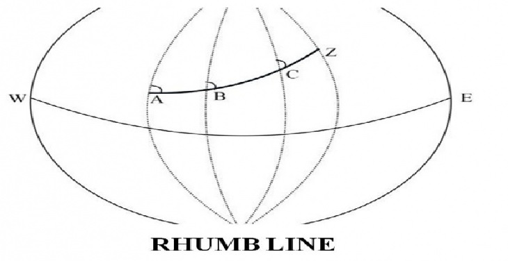
Description
1-an imaginary line on the earth's surface cutting all meridians at the same angle, used as the standard method of plotting a ship's or plane course on a chart.
2-any of the 32 points of the compass.